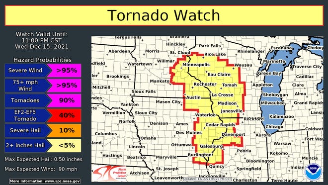
A powerful December storm system raced across Wisconsin Wednesday night, bringing the bizarre threat of winter tornadoes over snow-covered acres.
Once the storms passed, gusty winds moved in and were expected to stay well into Thursday.
The winds downed trees and power lines across central and western Wisconsin. A gust of 69 mph was reported in Viroqua while gusts hit 54 in Marshfield, 62 in Viola, 69 in Wisconsin Rapids and 67 in Eau Claire.
It was a historic storm, according to the National Weather Service. Wednesday set the record for the most hurricane force (75+ mph) thunder wind gusts in a day since at least 2004. The previous record was set August 10, 2020 with 53. There were 55 such gusts across the nation Wednesday as of 9 p.m.
The first tornado warning in Wisconsin was issued just after 8 p.m. for Whitehall and an area southwest of Eau Claire. It expired at 8:45 p.m. Thunderstorm warnings were issued for western Wisconsin from La Crosse to the Rice Lake area.
A second tornado warning was issued for Clark and Taylor Counties at 9:07. This storm was moving into Loyal and Greenwood by 9:20. It expired at 9:45.
As the night wore on, the storm lost some of its energy, but the winds behind it will last all night and into the morning.
The Milwaukee area was expected to miss the worst of the storm, but will have the high winds into the morning. Just before 9 p.m., the temperature at Mitchell International in Milwaukee was 65 with winds gusting to 45 mph.


No comments:
Post a Comment