Showing posts with label NWS. Show all posts

Monday, July 27, 2026

Amid storms, flash flood warning issued for Racine and Kenosha County

From JSOnline:

Jack AlbrightCaden Perry

The thunderstorms blanketing much of southern Wisconsin have hit Kenosha and Racine, prompting the National Weather Service to issue a flash flood warning in both counties until 3 p.m. Monday, July 27.

Between 2 and 3 inches of rain have already fallen, with another 1-2 inches possible. The additional rain is expected to flood small creeks, streets — including highways — along with low-lying areas.

The National Weather Service recommends residents turn around when encountering flooded roads and not try to drive through them.

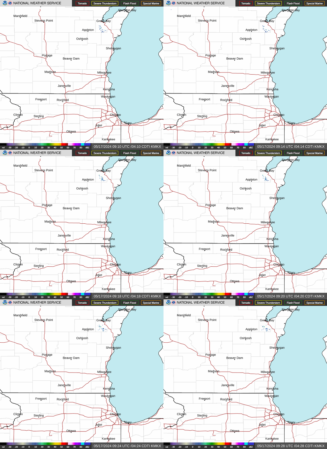
See weather radar for Racine County
What is a flash flood?

A flash flood is a flood caused by heavy or excessive rainfall in a period of 6 hours or less, according to the NWS.

Flash floods are usually characterized by sudden onset torrents that develop after heavy rains. A flash flood can take just minutes to develop and is possible in areas not immediately receiving rain.

What's the difference between a flash flood watch and a flash flood warning?

A flash flood warning is issued when a flash flood is imminent or occurring. If you are in a flood prone area and receive a warning, you should act immediately and move to high ground.

In contrast, the NWS only issues a flash flood watch when flash flooding is possible but not occuring imminently.

What to do during a flood warning

  • Evacuate immediately if advised to do so.
  • Use a battery-operated radio or television to get the latest emergency information.
  • Do not walk through floodwater. It only takes six inches of floodwater to sweep you off your feet if it is moving swiftly.
  • Turn around, don't drown; do not drive into a flooded street. Cars can be swept away by two feet of moving water. There may be unseen damage to the road as well. If you come to a flooded area, turn around and go another way. Most flood-related deaths are caused by people driving through water.
  • Watch out for fire hazards.
  • Move to higher ground.
  • Stay alert, turn weather notifications on.
  • Do not allow children to play in flowing water. Waters can hide rocks, trees and debris.

Wednesday, June 3, 2026

Air quality alerts are back, but this time, wildfires aren't to blame

From JSOnline:

Caden Perry
Milwaukee Journal Sentinel

atmos

Don't the Milwaukee skies look too clear for an air quality alert?

Yes and no. Your eyes aren't fooling you, the skies are clear Wednesday, June 3. Canadian wildfires are not at a level where smoke is carried across the Midwest yet.

But the air is still poor quality. The National Weather Service issued an air quality alert June 3 morning, the first one in 2026. An uncommon set of weather conditions is actually trapping ozone on the ground level we breathe in.

Normally, ozone emissions rise higher into the atmosphere. A layer of warm, slow air is holding those emissions down in what National Weather Service meteorologist Benjamin Sheppard described as a subsidence inversion pattern.

Ozone is highly toxic to the respiratory system and the American Lung Association describes it akin to a sunburn for your lungs. It forms in a reaction between nitrogen oxide and sunlight.

Milwaukee has an abundance of sunlight June 3 with sunny skies expected to persist all day Wednesday and Thursday, June 4.

Strung all together, industrial nitrous oxide is reacting to ample sunlight but the ozone byproduct isn't leaving our breathing air like it should.

Canada wildfires still too far away from Wisconsin for smoke concerns

It's tough to call out smoke forecasts very far in advance. Even if wildfires in Canada get to the abundant levels, the smoke might never affect Wisconsin if the weather doesn't carry the smoke to the area.

According to the Canadian Interagency Forest Fire Centre, there are only a handful of wildfires near the Wisconsin border, and most are being held back as of June 3 morning.

The biggest threat for smoky conditions in Wisconsin are two Ontario wildfires considered "out of control," one east of Lake Nipigon and another east of Thunder Bay.

With winds moving especially slow in Wisconsin, it is highly unlikely the smoke will carry over to any part of the state.

Sunday, March 15, 2026

City of Racine declares snow emergency from Sunday to Tuesday


Milana Doné


RACINE — The city's Commissioner of Public Works has declared a snow emergency effective from 3 p.m. Sunday until 6 a.m. Tuesday.

According to a City of Racine news release, the declaration is meant to aid the snow removal operations.

No parking will be permitted on either side of the city's arterial or collector streets. Alternate side parking will be in effect from 2 a.m. to 6 a.m. per city ordinance. 

Parking restrictions will allow crews to remove as much snow as possible from city streets, the release said. Vehicles parked in violation of these restrictions will be ticketed and subject to towing.

An outline of the Snow Emergency Parking Restrictions and list of affected streets can be found at https://cityofracinewi.gov/publicworks/snowemergency/.

According to meteorologist Benjamin Sheppard at the National Weather Service Milwaukee/Sullivan station, some of the predictions regarding the incoming snow storm have shifted from yesterday.

The system is still expected to begin with rain and could bring a wintry mix as it transitions to accumulating snowfall. However, it will take longer to reach the Racine and Kenosha areas than originally predicted.

A wintry mix and rain will reach southeast Wisconsin by Sunday morning. Some thunder and hail are possible Sunday morning as well.

Coming from central Wisconsin, the snow front will reach Racine and Kenosha areas between 7 p.m. Sunday and 1 a.m. Monday.

Snow will begin accumulating then and keep falling into Monday morning. Lighter accumulations will occur Monday afternoon.

Most of the snow accumulation will happen six to 12 hours after the snow starts, Sheppard said.

Because it will take longer than originally predicted for the snow front to reach southeast Wisconsin, total accumulations for Racine and Kenosha are down from prior estimates. They are now 3-6 inches.

By midday Sunday, Racine and Kenosha could see wind gusts of up to 35 mph. Sunday night gusts may reach upwards of 45 mph.


Your local TV meteorologist is not judged by the accuracy of his/her forecasts, but by the ratings that he/she generates.  Thus we have the shouting and foaming at the mouth and the inane warnings about future events that they have little knowledge of.  I've seen the city of Racine needlessly shut down a number of times due to these faulty forecasters.  I spent my final years on the job outdoors, in the landscape.  I learned to trust my own instincts rather than the babbling of some shill on the TV or radio.

Friday, March 13, 2026

High Wind Warning until FRI 4:00 PM CDT

From The Journal Times.com:

High Winds Expected Until 4 PM CDT Friday, Potential for Power Outages

What’s Happening:

A High Wind Warning is in effect until 4 PM CDT Friday. South winds will shift to the west, maintaining speeds of 20 to 30 mph with gusts up to 60 mph.

Affected Areas:

  • East Central Wisconsin
  • South Central Wisconsin
  • Southeast Wisconsin

What to Expect:

  • South winds 20 to 30 mph, shifting to west winds 20 to 30 mph.
  • Wind gusts up to 60 mph, especially during precipitation.

Impacts:

  • Potential for trees and power lines to be blown down.
  • Widespread power outages likely.
  • Difficult travel conditions, particularly for high-profile vehicles

Safety Tips:

  • Stay in the lower levels of your home and avoid windows.
  • Be alert for falling debris and tree limbs.
  • Use caution if you must drive; consider postponing travel if possible.

When to Check Back:

Monitor weather.gov or journaltimes.com/weather for updates.

This weather alert was produced with AI assistance using National Weather Service data.

From: https://journaltimes.com/news/local/weather/article_71ad5461-b73e-5d3f-8db1-624e0239f122.html#tracking-source=home-the-latest

Weekend system could bring up to 12 inches of snow to Kenosha and Racine counties

From The Journal Times.com:

Milana Doné 


RACINE — Southeast Wisconsin can expect a storm system this weekend, bringing rain, freezing rain and snow accumulations.

According to meteorologist Michaela Heeren at the National Weather Service Milwaukee/Sullivan station, the system is expected to begin with rain or a wintry mix on Saturday evening. It will be mainly rain for Kenosha and Racine areas, but the counties could see sleet mixing in if the temperatures fall below freezing.

Then, there will be a period of rain Sunday morning as temperatures warm again.

The rain will change back to freezing precipitation by the afternoon hours Sunday and then to snow in the overnight hours. The snow could accumulate between six and 12 inches because of lake enhancement.

“We have quite a bit of moisture that comes off the lake when we have melting patches, which will allow for taller clouds which will allow for moisture to be created into snow and fall across the lakeshore counties,” Heeren said.

Heeren clarified the enhancement isn’t exactly a lake effect snow band where there is a short window of snow but a broad scale snowstorm with “locally higher snow totals from that lake enhancement.”

Temperatures will fall below freezing Sunday night so most of snow will stick as it falls.

"Going into Monday, as well, we are expecting those temperatures to remain below freezing, so there’s not going to be a lot of melting once the transition (to snow) happens,” Heeren said.

The upcoming snow system will also bring widespread gusts of wind, which could reach 30-40 mph, Heeren said.

Sunday’s windchill be in the 20s. Overnight, between Sunday and Monday, the wind chill could reach zero.

Heeren noted this can cause worse visibility during driving conditions.

She said the National Weather Service expects transportation to be impacted by the weather, particularly when the sleet is transitioning to snow.

“Go slow, especially during the period of snowfall,” Heeren said. “Be prepared to have traction in your car, a shovel and anything that is available to be more protective if you’re going out during the time of snowfall.”

From: https://journaltimes.com/news/local/weather/article_03bb66ba-4dcc-404c-9be5-f0927ae3a1c7.html#tracking-source=home-top-story

Thursday, March 12, 2026

Late winter storm could drop up to a foot of snow in Milwaukee this weekend

From JSOnline:

Maia Pandey
Milwaukee Journal Sentinel

70-degree weather followed by potentially one of the biggest snow storms of the season: welcome to March in Milwaukee.

Just days after this week's spring-like weather, heavy snowfall is expected to hit central and southern Wisconsin and could lead to more than a foot of snow in some areas, according to Michaela Heeren, a meteorologist with the Milwaukee/Sullivan National Weather Service.

The snow will impact central and southern Wisconsin, but it's unclear so far which areas will be hit hardest, Heeren said. Snowfall will start around 6 p.m. Saturday, March 14, continue through the weekend, before finally tapering off the morning of Monday, March 16. The heaviest snowfall will likely be on Sunday.

So far, forecasters are most confident central Wisconsin will see hefty snow accumulations up to a foot, Heeren said. Depending on how the band of snow travels, the Green Bay area could be hit harder, while Milwaukee gets more sleet and freezing rain than snow.

Even in that case, southeast Wisconsin could get around 6 inches of snow on the "back side" of the storm, Heeren said.

On the other hand, the heaviest band of snow could hit southeast Wisconsin directly and lead to snow accumulations as high as 12 to 18 inches, she said.

Here's why Racine received more rainfall than other parts of SE Wisconsin on Tuesday

From The Journal Times.com:

Holly Gilvary


RACINE — While a narrow swath of heavy rainfall Tuesday night that spanned from Lake Geneva to Racine left significantly more rain locally compared to the rest of Southeast Wisconsin, Racinians can expect a drier end to their week.

The greater Racine area received 2.5 to 3 inches of rain Tuesday night into early Wednesday morning, compared to about 1.7 inches in Burlington and half an inch in Kenosha and Milwaukee, according to the National Weather Service.

NWS Meteorologist Marcia Cronce said "repeated rounds of individual cells of storms" caused the band of heavier precipitation.

"This fairly typical," she said. "We call it (thunderstorm) convection. You always get localized areas of higher versus lower precipitation. It just depends on where the storms track."

A light snow and rain mix was expected for Wednesday evening in Racine, according to Cronce.

Another round of light rain with a possible snow mixture is forecast for Racine on Thursday evening, Cronce said. Friday will be windy, but dry.

Recent stories by Racine Journal Times reporter Holly Gilvary

From: https://journaltimes.com/news/local/weather/article_a308d574-2944-4102-bf02-2e084215288f.html#tracking-source=home-top-story

Tuesday, January 20, 2026

Bitter wind chills to stay in Racine and Kenosha this week

From The Journal Times.com:

Milana Doné

Racine and Kenosha counties can expect frigid wind chills the rest of the week.


RACINE — Racine and Kenosha counties can expect frigid wind chills the rest of the week.

According to meteorologist Benjamin Sheppard of the National Weather Service Milwaukee/Sullivan station, Wednesday will bring highs in the mid 20s and single digit lows. The wind chill will be around 10 degrees, falling into the single digits overnight.

Early Wednesday morning is supposed to bring three to four inches of snow. The winter weather advisory will end at 6 a.m. Wednesday, but the snow may still affect the morning commute.

Wednesday's temperatures will help the salt on the roads be more effective as the day goes in. Caution should still be taken on the evening commute.

There will be a lull during the day before the snow returns Wednesday evening shortly after 5 p.m. until around midnight. Sheppard said it will yield an additional half an inch to an inch and a half of snow.

This precipitation is not lake effect snow, he said.

“Based off of the wind’s direction that we’re getting with this, this will just a good old synoptically, system-driven snowfall. None of that snow will be lake effect or lake enhanced,” Sheppard said.

Thursday will have highs in the teens and lows from negative 7 to negative 12. The windchill Thursday night into Friday is slated to reach into the negative 20s.

Friday will see highs around zero or slightly below while lows are predicted to be between negative 7 to negative 14.

Sheppard said the worst cold will be Thursday night into Friday. The National Weather Service has not officially released an advisory as of Tuesday morning, but he expects there will at least be a cold weather advisory.

“Depending on how things trend in that time window, we are potentially considering an extreme cold watch which would then be upgraded into an extreme cold warning,” Sheppard said.

If there is an official advisory, he said those are often put in place at least 24 hours prior to the beginning of the extreme conditions.

Sheppard recommends taking precautions for the cold and snow this week.

Suggestions include budgeting plenty of travel time to reach destinations and even considering avoiding travel if it is not necessary.

Additionally, people in Racine and Kenosha counties should be bundling their winter clothes, dressing in layers, reducing time spent outdoors, keeping pets indoors and ensuring heaters and furnace exhaust outputs are unclogged to combat carbon monoxide risks.

From: https://journaltimes.com/news/local/article_17946049-0a03-41cb-94e2-fe2729e0ef84.html#tracking-source=home-top-story

Saturday, November 29, 2025

Up to 10 inches of snow possible for Racine, Kenosha counties Saturday

From The Journal Times.com:

Holly Gilvary


RACINE COUNTY — Racine and Kenosha counties should prepare for a snowy weekend as the biggest snowstorm since 2023 rolls into southern Wisconsin.

Six to 10 inches of snowfall are possible in Racine County and 5-9 inches are estimated in Kenosha County, according to the National Weather Service.

A winter storm warning goes into effect for southeast Wisconsin starting 3 a.m. Saturday morning until 6 a.m. Sunday. 

Snow emergencies declared

In Kenosha County, the City of Kenosha and the villages of Pleasant Prairie and Somers have issued snow emergencies.

Kenosha's snow emergency starts at noon Saturday and ends at 7 a.m. on Monday; Pleasant Prairie's will last from midnight Saturday to noon Sunday; and Somers' will be in effect from noon Saturday through noon Sunday.

In Kenosha, parking on all city streets will be prohibited, allowing public works crews more space to plow the streets during and after the snowstorm; however, the city will allow overnight parking in designated Downtown and Uptown city parking lots to ease the burden of finding parking during snow emergencies.

Residents should observe posted snow route regulations.

During declared snow emergencies, city residents may park on front lawns. It is illegal to blow, plow or shovel snow into city streets.

In Pleasant Prairie, no parking is allowed on village streets during the declared snow emergency. All snow emergency parking restrictions will be enforced throughout this time period.

For more information about Pleasant Prairie's Snow and Ice Removal Plan, visit https://www.pleasantprairiewi.gov/cms/one.aspx?pageId=10822557.

In Somers, parking is prohibited on roadways during a snow emergency to allow for crews to clean up the roads. Residents are reminded to park their vehicles accordingly.

Kenosha County Highway crews readied equipment on Friday.

"We are prepared; we're ready," said county Highway Director Greg Boldt. "As we monitor the forecast, crews will be deployed as needed to begin snow removal operations."

In Racine County, Sturtevant and Mount Pleasant have declared snow emergencies.

Sturtevant's snow emergency will last from 6 a.m. Saturday through 6 a.m. Sunday. All vehicles must be off village streets during the snow emergency to ensure safe and efficient plowing.

Mount Pleasant is under a snow emergency from midnight Saturday until noon Sunday. Parking restrictions will be in effect during that time.

During the snow emergency, parking is only allowed on village streets where alternate-side parking regulations are in effect year-round.

Mount Pleasant residents must also clear snow from the sidewalks along their properties by 10 a.m. of each day during a snow storm.

In an email Friday morning, Racine Police Department Public Information Officer Sgt. Alicia Mitchell said if the Racine Department of Public Works declares a snow emergency, parking restrictions will be enforced and citations and towing are applicable. Updates will be shared on the city's Facebook page, she said.

When will the snow start?

Snowflakes will likely start to fly at 3 a.m. in Racine and Kenosha when the winter storm warning takes effect, and snowfall will increase after daybreak, according to NWS Meteorologist Kevin Wagner. More accumulation is expected later Saturday morning and into the afternoon.

"The heaviest, highest snowfall rates definitely look to be late Saturday morning into the afternoon, early evening hours," he said.

Snowfall totaling less than half an inch may still occur on Sunday after the winter storm warning expires.

Communities immediately along the lakefront may receive a wetter snow with lower snow amounts, as Lake Michigan's temperatures are still fairly warm in the 40s, Wagner said. Areas farther inland, such as Burlington and Twin Lakes, may see higher amounts of snowfall.

Travelers heading home after the Thanksgiving holiday should pay attention to the forecast and may even need to alter plans Saturday to avoid dangerous road conditions, Wagner said.

"It's going to be a lot of snow on the roads and it's going to be maybe a little bit challenging (for snowplows) to keep up in keeping them clear, because (the snow is) just going to continue," he said.

While the snowfall will slow Sunday evening, temperatures are expected to drop.

Racine and Kenosha counties will both see low temperatures in the single digits Sunday night, and high temperatures Monday in the low 20s. Winds are not expected to be strong, but could bring sub-zero-temperature wind chills, according to Wagner.

Kenosha County tree lighting rescheduled

Kenosha County also has postponed its planned outdoor holiday tree lighting ceremony in Petrifying Springs Park in Somers. Originally scheduled Saturday afternoon, it has been moved to 5 p.m. on Sunday.

John Sloca of the Kenosha News contributed to this story.

From: https://journaltimes.com/news/local/weather/article_1eda2b3d-6e66-4e1f-9431-bbcf7c5ac230.html#tracking-source=home-top-story